Today i flew down to Christchurch with one of our Operations Scientists at GeoNet (and acting Network Development Manager) Lara. Our task is to replace batteries from our temporary seismic sites around Christchurch, take down some test sites, and scope around for new test areas for permanent sites.
It was a beautiful sunny day, with the odd patch of snow around, left over from last weeks storm! After getting our hire 4WD, we met up with a ChCh based GNS technician who loaded us up with batteries, we then went to our storage lockup and grabbed some more gear (shovels, concrete etc.) and we were off to our first site.
 |
| Loading up! |
 |
| The Christchurch GeoNet temp. storage unit. |
|
|
|
|
|
 |
| Berry Farm |
The first site we visited was not far from the airport, and in a farm, so easy access. It is a temporary seismic instrument put out following the Canterbury earthquakes. Technicians have to come out every few months to change the data cards, and replace the batteries.
 |
| Summit road - lots of snow left |
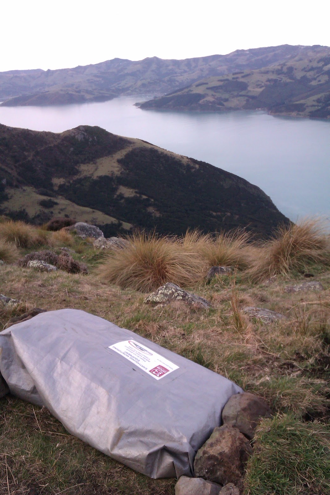
We then drove to Akaroa via Summit Road, and to the test sites. These are sites carefully chosen by scientists (with maps) to increase our coverage of the Canterbury region (along with NZ as a whole). Technicians then go out in the field (I'll go into this more tomorrow) and install the test sites for a few months, and these are then recovered and the data studied to see how the readings are (eg if its too noisy)
All that is left is a rebar pole and a few rocks painted bright
pink for the boys (so they can find the correct area) to go out and install the 'proper' site later on!
 |
| Dismantling the first site |
 I I |
| I think the boys should be able to find this! |
 |
| The sun was setting, and the cows were coming in for a look. |
The recent snow, and its melting had made the paddocks pretty muddy so we had to lug all of the equipment back to the ute via foot, the batteries weigh 24kg - so this was a good work up for dinner! The last site we went to, the road was actually blocked by about a foot of snow, so we had to scale fences as well (i'm a shocker at this!) as carry the gear accross the farms.
 |
| The last site, racing against the setting sun. |
 |
| Beautiful view |
We finally got to Akaroa at 7, after a quick dinner and shuffle of the batteries in the ute, its off to bed all ready for another big day back out in the beautiful Akaroa hills.


 The last stop was up Richmond Hill at Sumner, it was the first time i had been there since the Sept 4th quake, and wow what a difference. The roads were definitely 'munted' (a popular post-quake phrase) and it was surreal driving around the coast and seeing the wall of containers, to protect from the rockfalls, and the houses perched precariously on the edge of the cliff.


 I
I 

